About the project
Making mountain forecasts easier to compare.
Hi, I’m Cormac Smith, a Product Manager who enjoys turning complex problems into useful, approachable experiences.
I built Summit Outlook to help answer a practical question when planning a hike: which mountain offers the best chance of a clear view when I reach the summit?

The problem
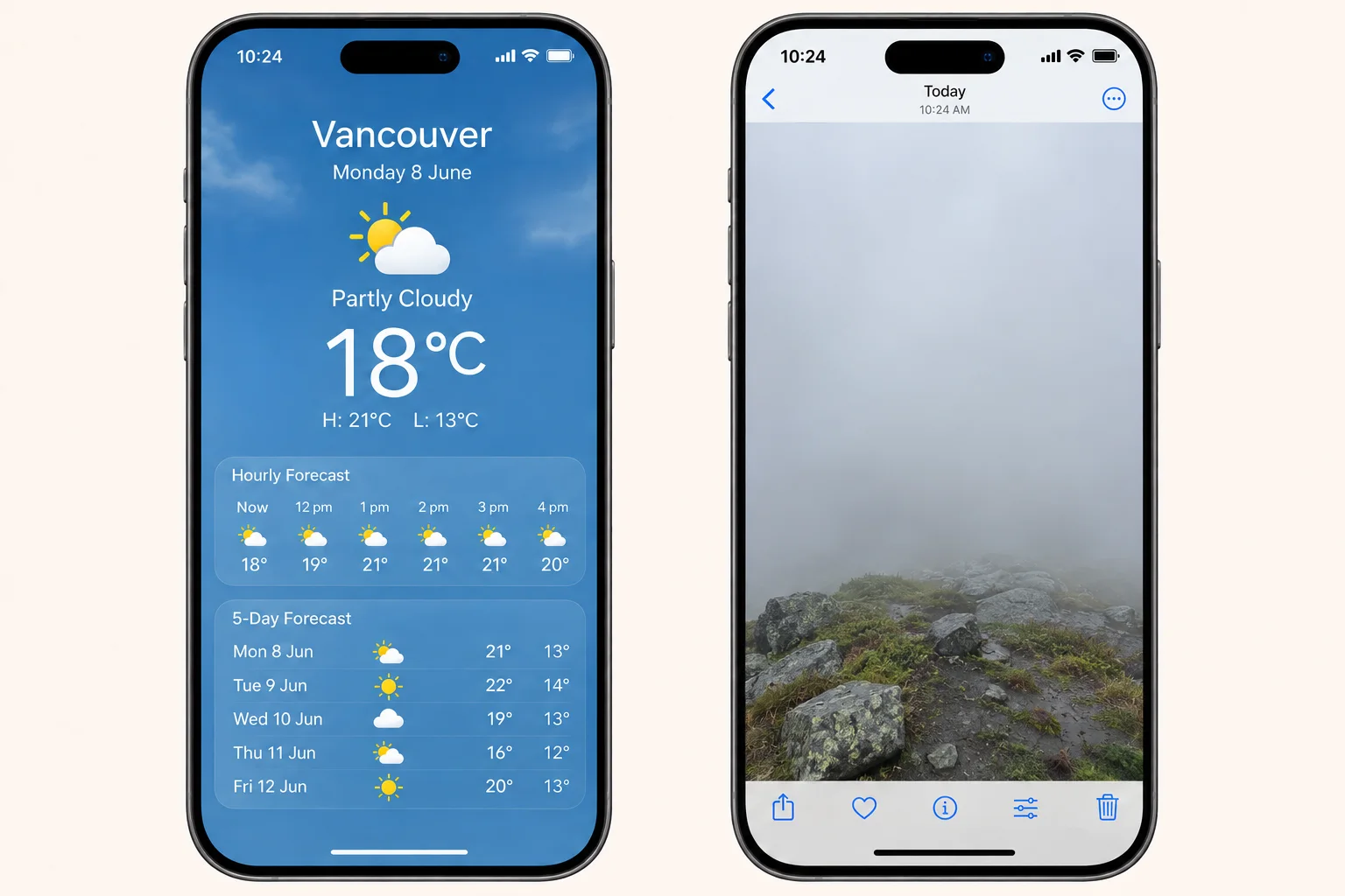
Checking a phone’s weather app or searching for “weather in Vancouver” gives a quick overview of local conditions. But a sunny forecast for the city doesn’t necessarily mean a clear view from a nearby summit. Elevation and local cloud can make the experience very different.
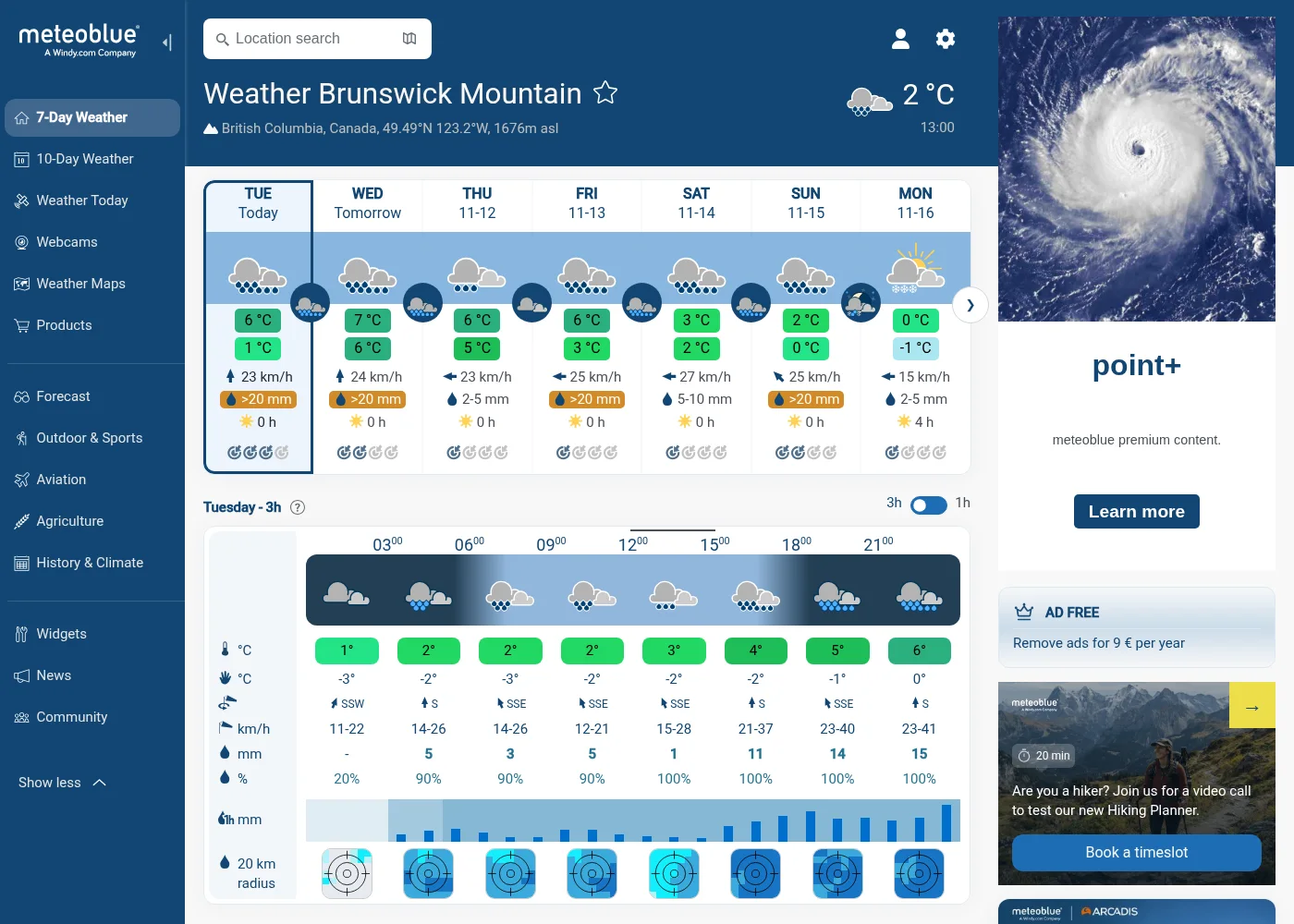
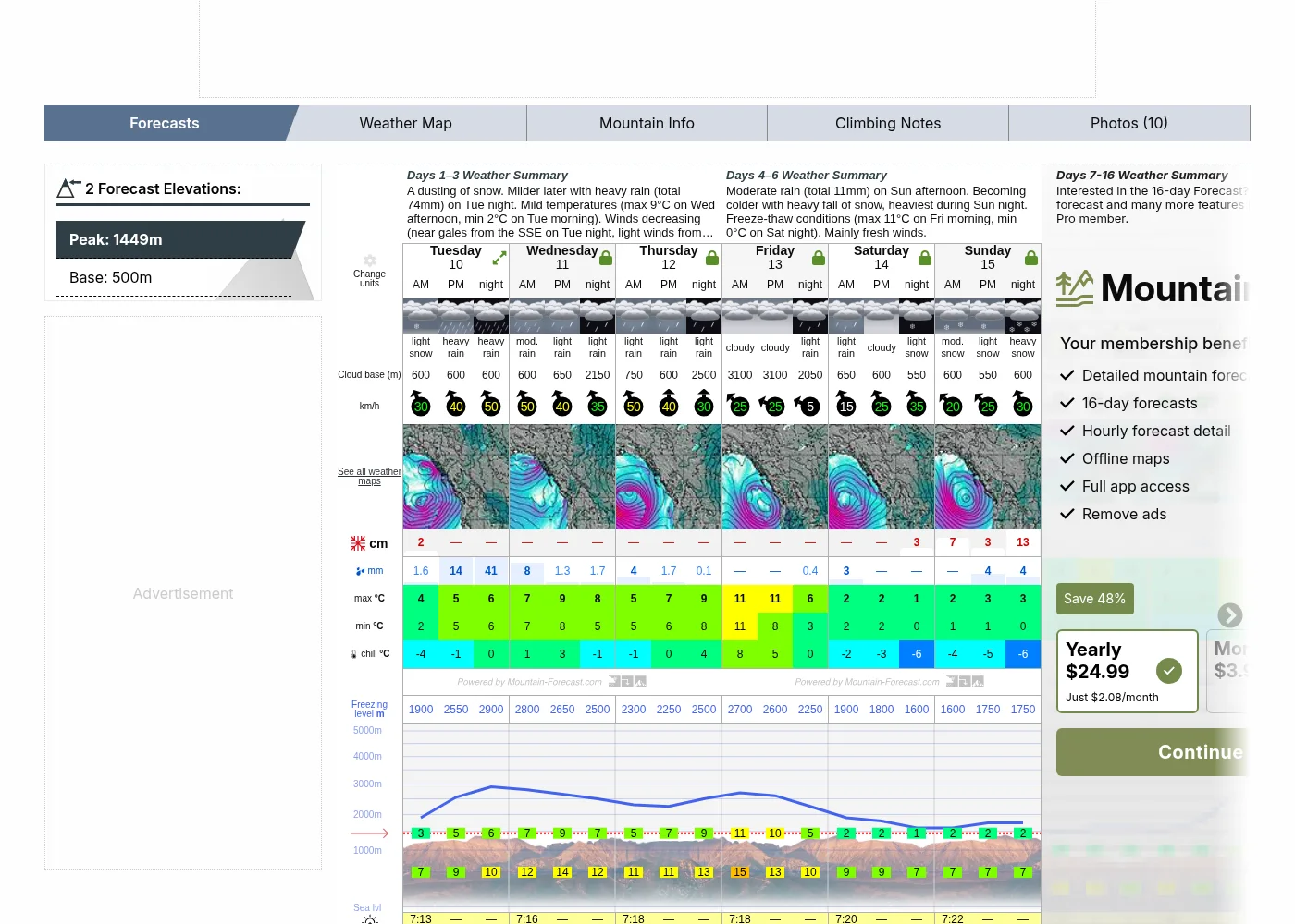
Mountain forecast websites offer more detail, including wind speed and direction, freezing levels, cloud cover and precipitation. That information is useful, but answering “where should I go?” can still mean checking several mountains separately and interpreting a lot of data.
The idea
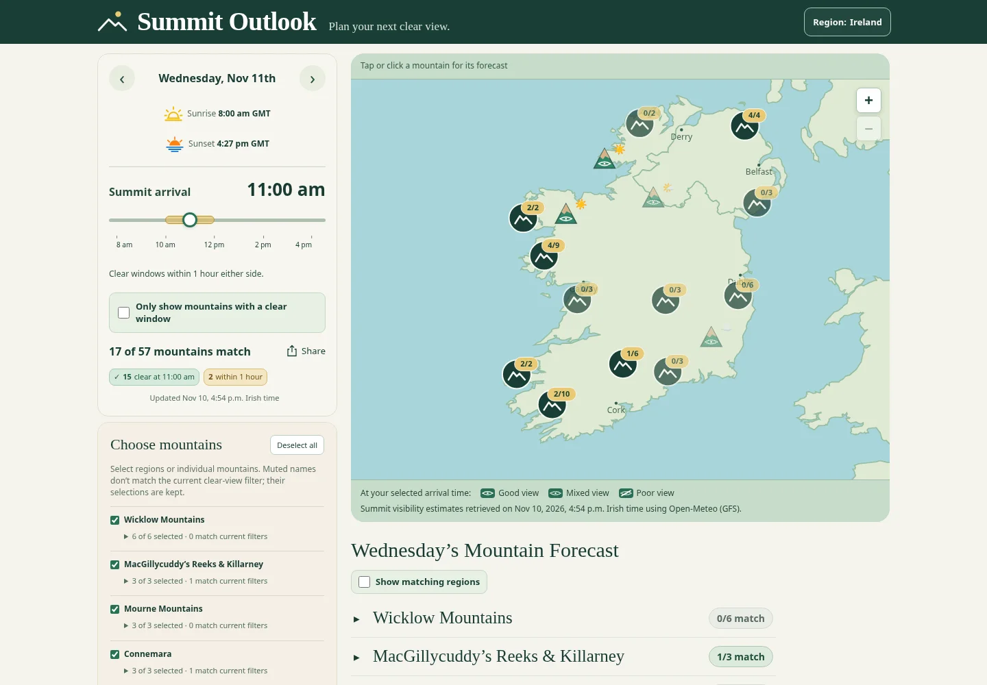
The idea was to make choosing a mountain as straightforward as checking the weather. I wanted to combine the familiar icons of a phone weather app with forecasts for many mountain locations, brought together in one place.
Choose a day and your expected summit arrival time, then compare mountains on the map. Hourly forecasts and clear-view windows help you see where—and when—you might have the best chance of a view.
I spend most of my time between Vancouver and Ireland, so they felt like natural places to start.
How the site evolved
These milestones show how the project developed through repeated rounds of design, feedback and refinement.
Revision numbers reflect recorded project changes, excluding routine weather updates.
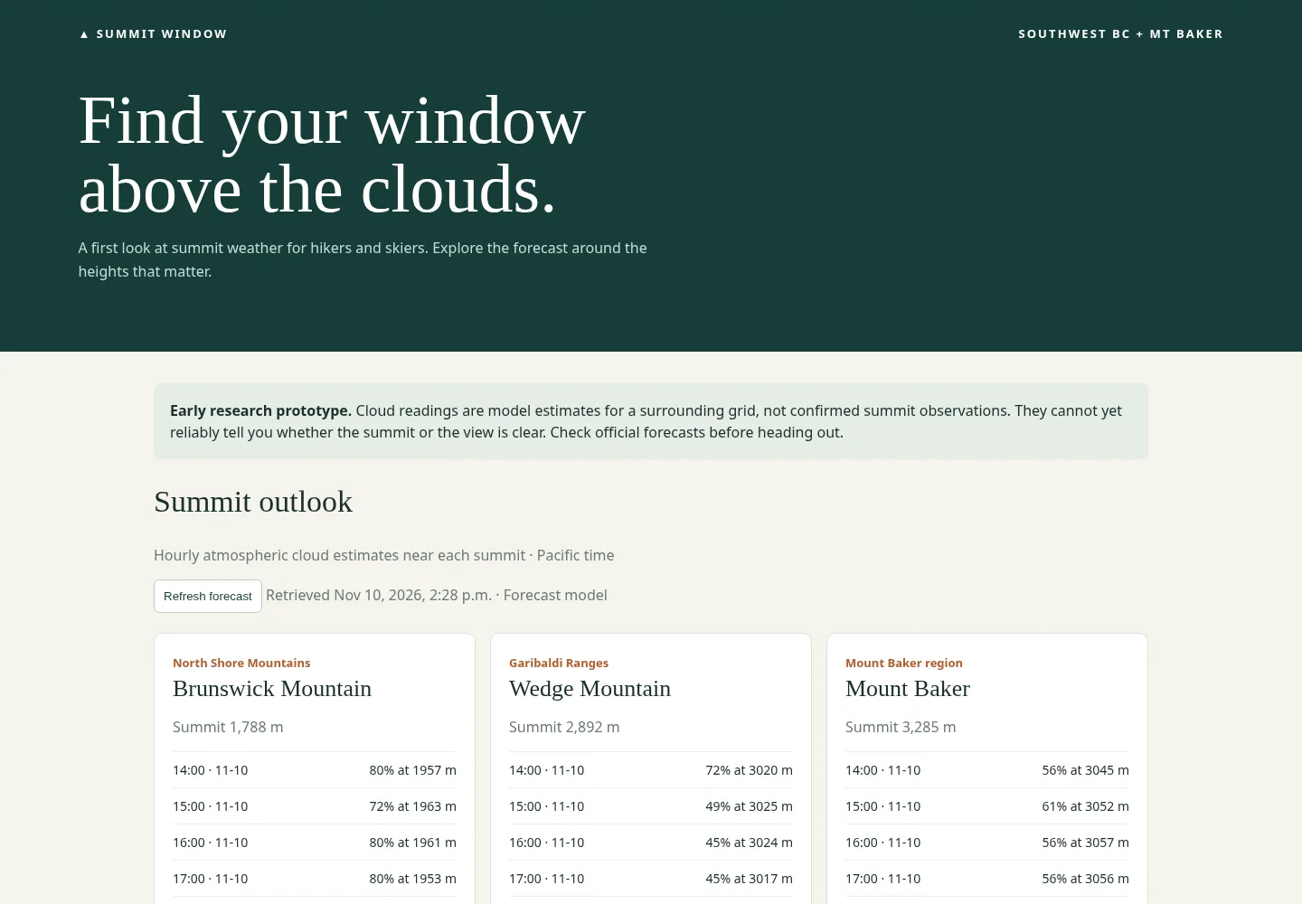
The first prototype
Initially called Summit Window, the site began with atmospheric data for three mountains and a simple set of forecast cards. The domain was already taken, so the name had to take a hike.
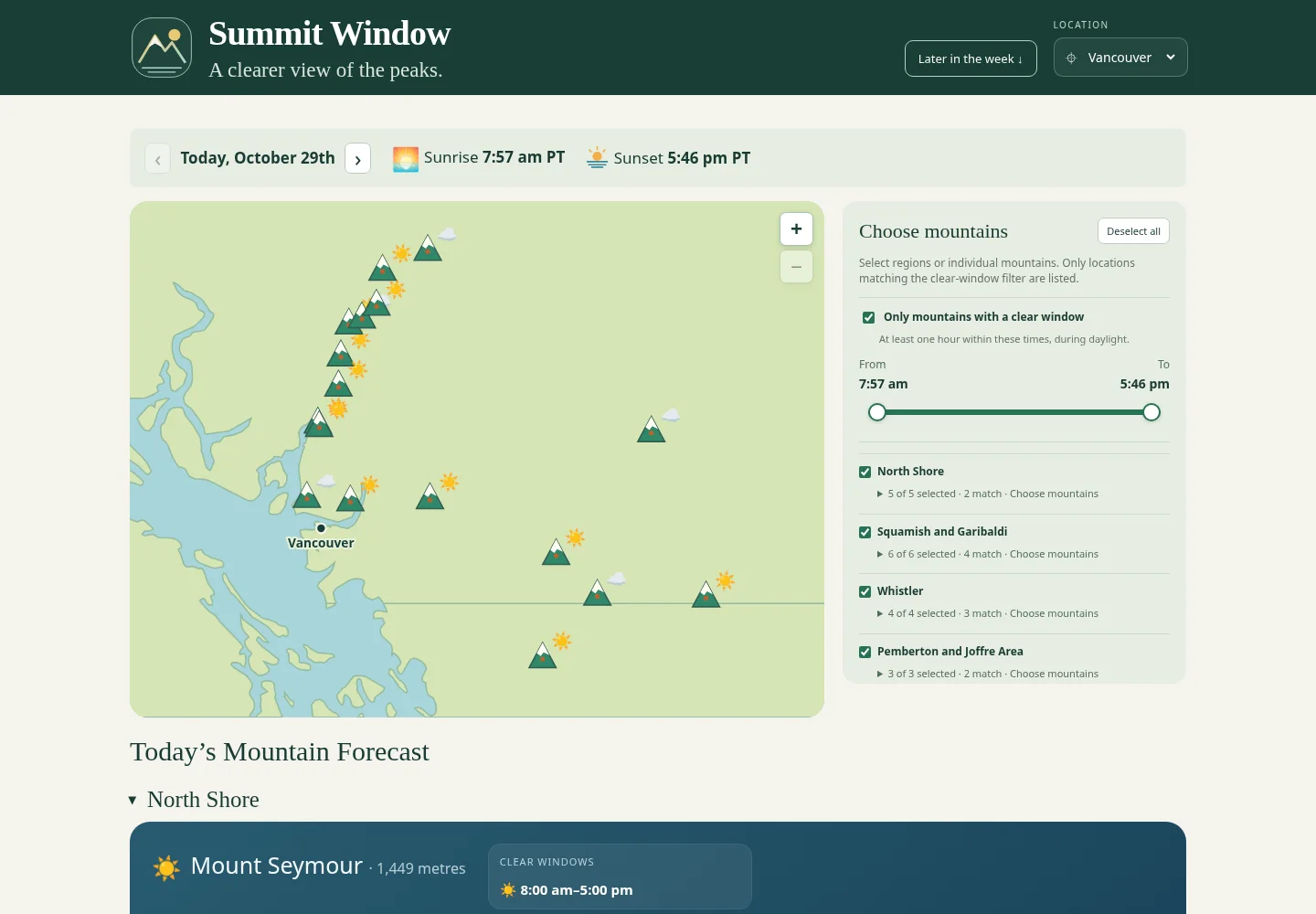
Introducing the slider
The first slider let visitors choose a range of daylight hours and filter the map for mountains with a clear window.
Summit Outlook today
The latest captured design brings together arrival-time planning, an interactive map, mountain forecasts and a choice of regions.
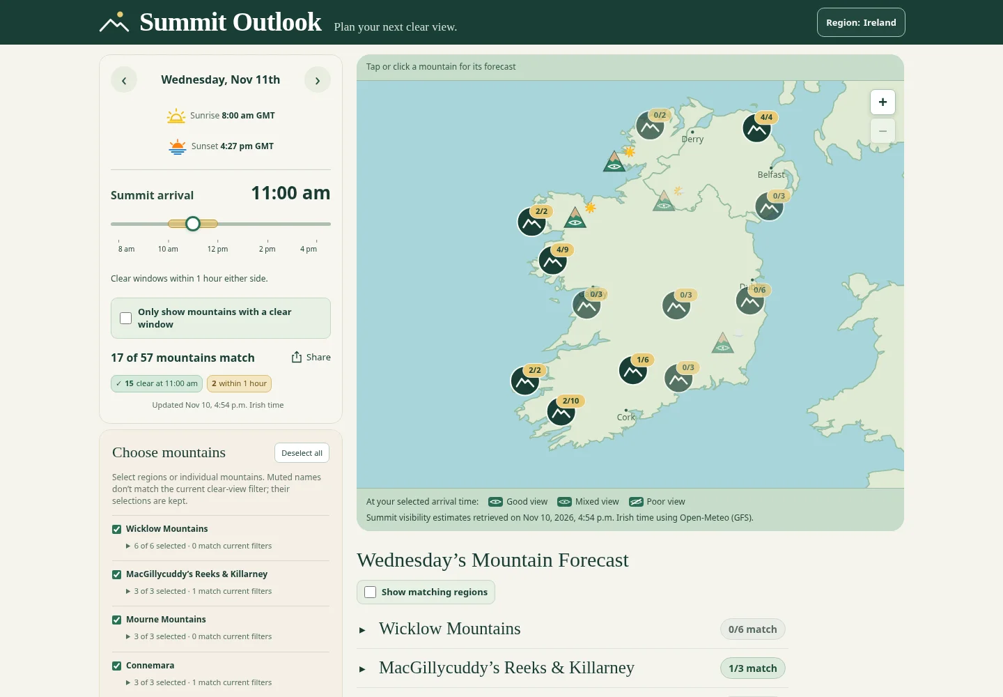
The early designs were recreated from archived code. Forecasts shown in these screenshots are examples captured at the time, not current conditions.
How it works
Summit Outlook retrieves weather forecasts from Open-Meteo through an API and refreshes them throughout the day.
I built a set of calculations that uses this data, together with each mountain’s location and elevation, to estimate summit visibility. The site translates those estimates into familiar icons and highlights daylight periods when clear views are forecast.
Mountain conditions can change quickly, so these estimates are a planning aid rather than a guarantee of a view.